In northern Chile, the ancient routes of the Inca Trail have survived invasions, climate shifts, neglect and silence. The stone paths of Socoroma—centuries old and without clear management—stand as a testament to that stubborn endurance.
The Inca Trail, named a UNESCO World Heritage Site in 2014, stretches across more than six countries and hundreds of communities that today face the same challenge: adapting to a climate that no longer follows the patterns of the past. In Socoroma, in the region of Arica y Parinacota, changes in rainfall, rising temperatures and depopulation are intertwined in a single story. What was once a network of trails connecting villages and ecosystems now fades among erosion, abandonment and the visible effects of climate change in the Andes.
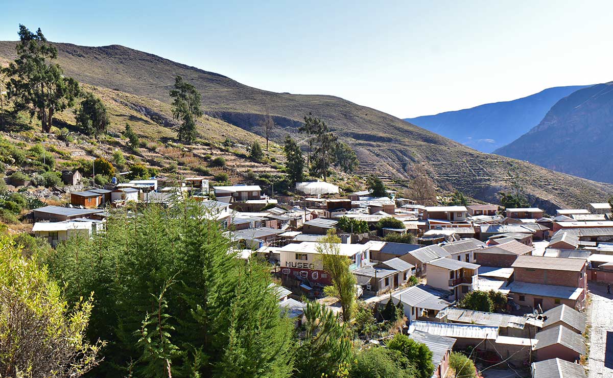
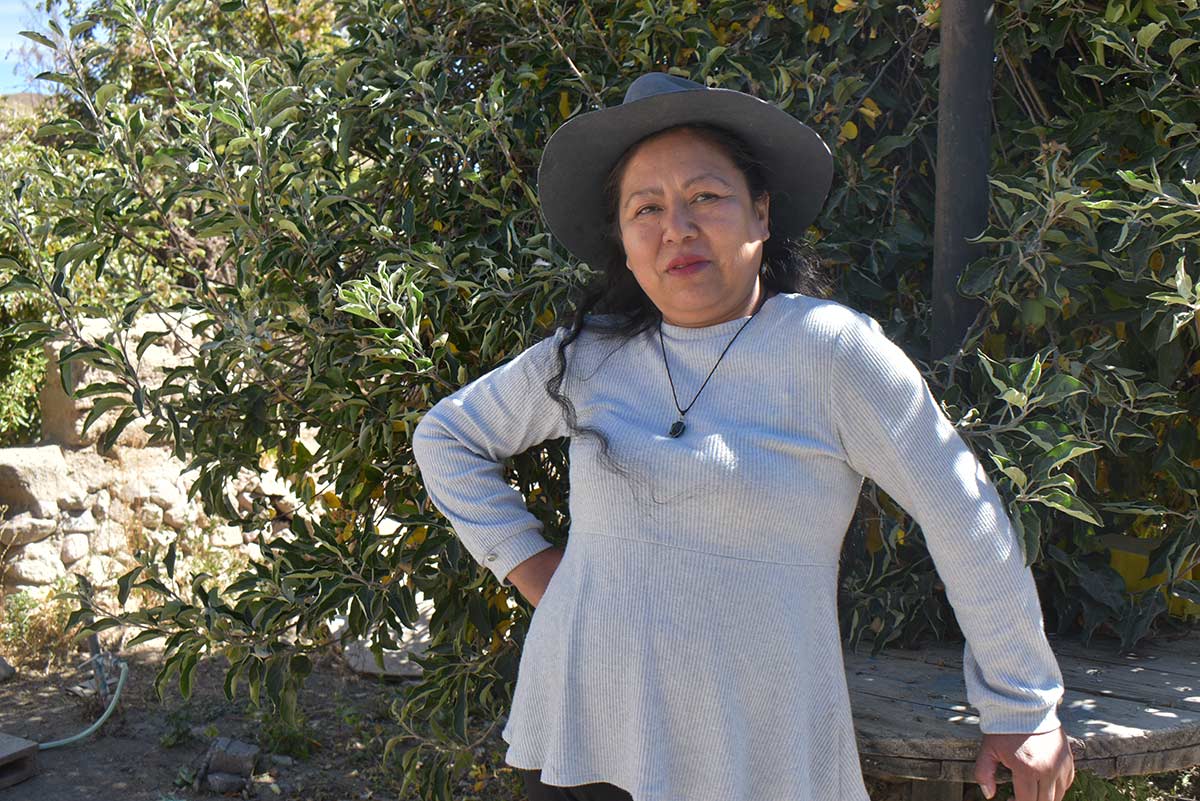
Entrance to Socoroma, located in the pre-Andean foothills of Arica and Parinacota region, Chile.
Photo: Natalie Gilbert
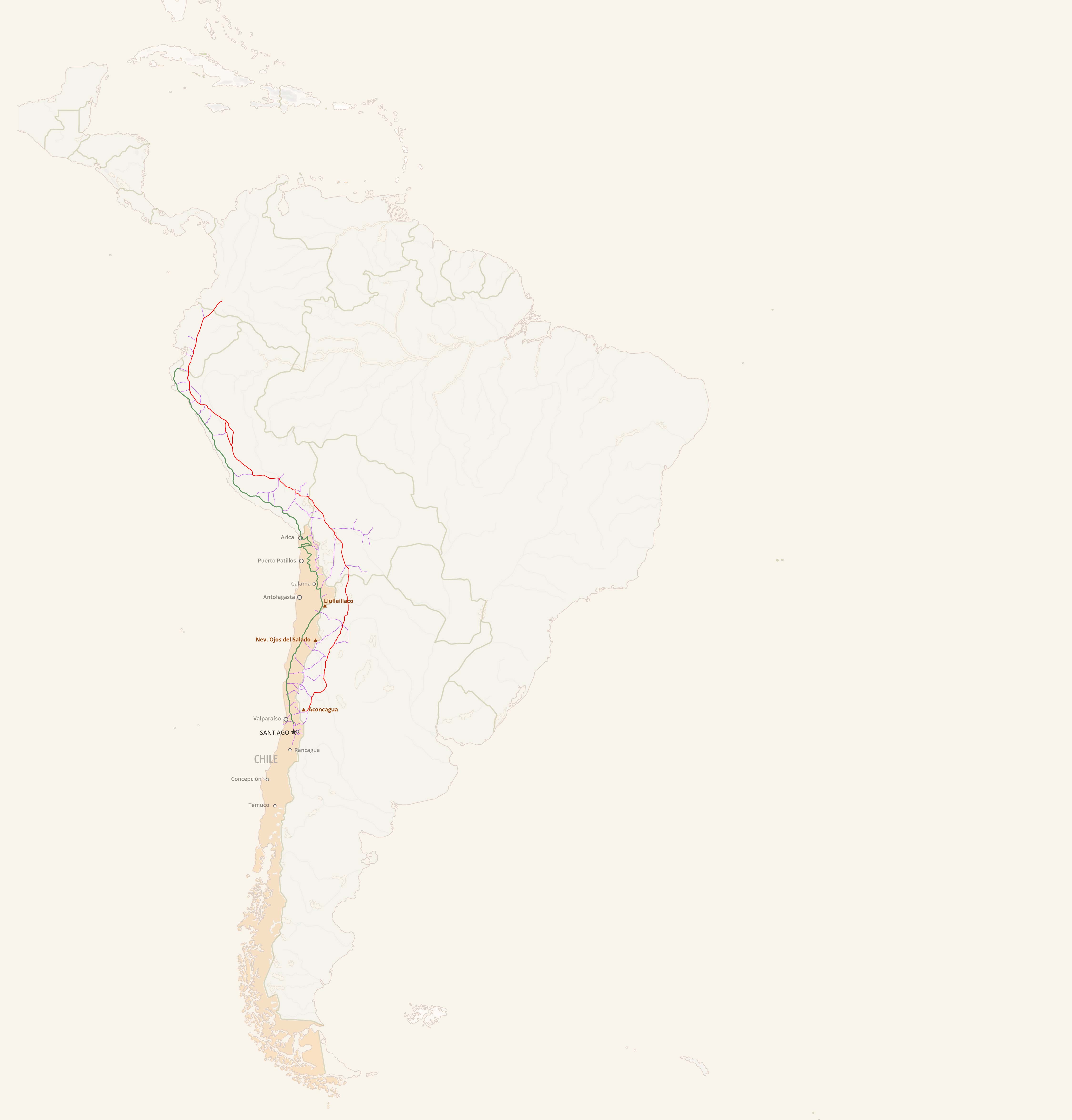
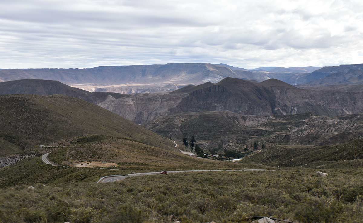
As the city of Arica recedes and the landscape begins to paint itself into view, the road linking this regional capital to Socoroma starts a long ascent, climbing steadily toward the peaks ahead. The road zigzags so insistently it seems to aim for the sky, finally rising above the clouds. The coast and the lowlands are left behind. Far ahead, the Andes reveal their full splendor.
Men and women gather their bags and boxes. After about 78 miles, it is time for the bus to stop. Amid roadwork, they transfer to a truck driven by Luis Gutiérrez who, besides being a farmer, transports passengers to town. The La Paloma bus continues on to Putre.
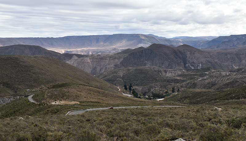
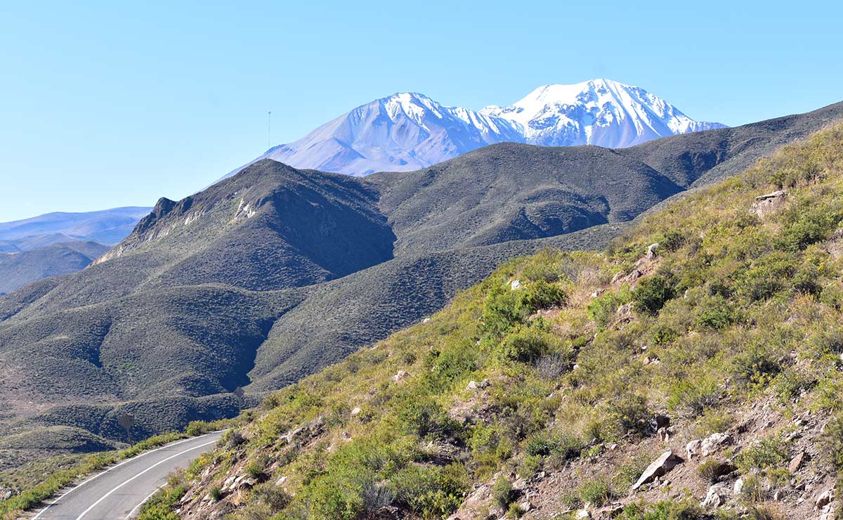
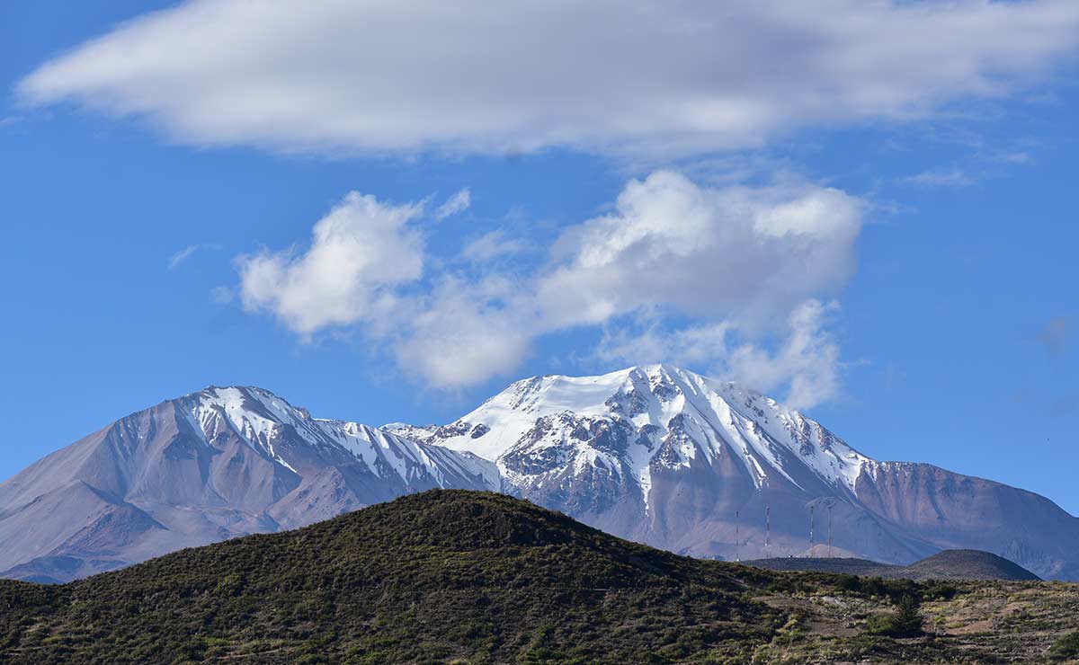
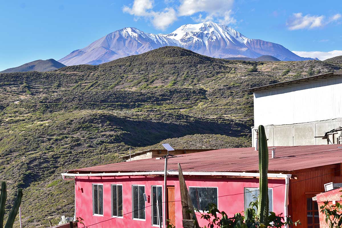
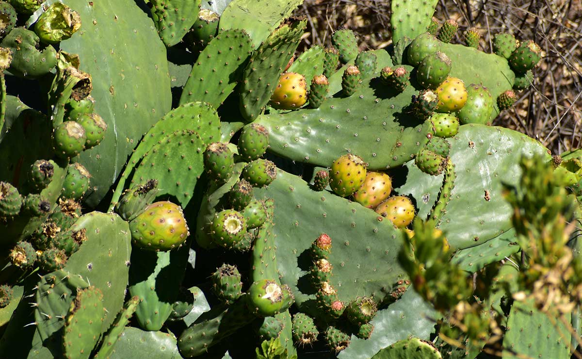
At over 10,800 feet above sea level, Luis’s truck—now full—descends sharp curves through a chain of hills washed in green, framed by the snowy cones of the Taapaca volcano. This same terrain was once crossed by the chasquis, the Inca messengers. Below, a village surrounded by terraced fields of oregano, an herb prized both for cooking and medicine, and the source of Socoroma’s fragrant identity. At the entrance, a sign reads “Welcome to Socoroma”.
Agricultural terraces surrounding the village are an ancestral custom.
Photo: Natalie Gilbert
Heritage at Risk
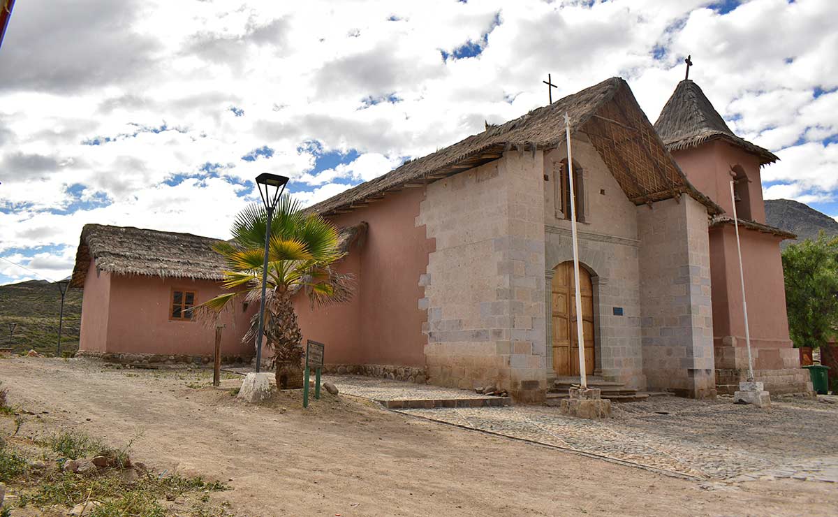
At first glance, Socoroma looks alive. But its empty streets, shuttered houses and doors bolted with heavy, rusted locks tell another story—one of pause, of absence. Sometimes a distant radio echoes through the surrounding canyons. Other times, only birdsong fills the square, fluttering among the colorful hibiscus that bloom in front of the church. Here, the Inca Trail faces a complex reality, in part because of the lack of maintenance of the trails. Once kept clear of vegetation and protected from flooding, this careful preservation of the Inca Trail has not been practiced for decades.
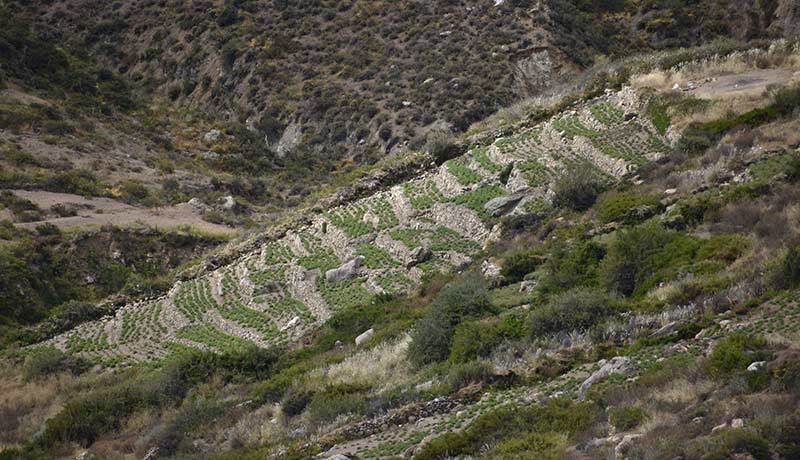
The San Francisco de Asis Church in Socoroma, last restored in 2013, stands at the heart of the town’s liturgical life with celebrations held throughout the year in connection to the Catholic calendar and inherited from Spanish colonization.
Photo: Natalie Gilbert
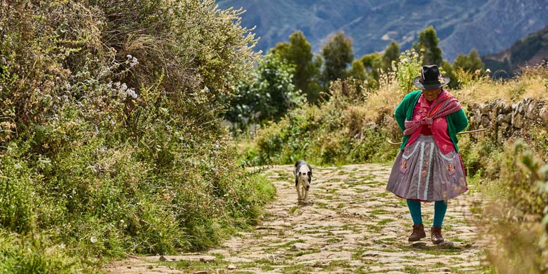
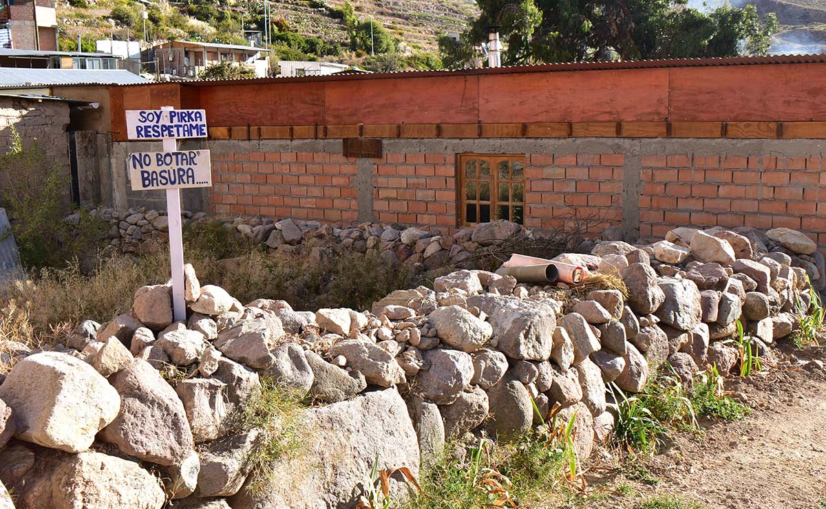
Fewer and fewer people live in the Andean foothills. In Socoroma, by the residents’ own count, no more than forty people remain. For generations, they have been compelled to migrate to the city, facing family separation and cultural uprooting. “It has been more than fifty years with the same public education policy. Schools here still only go up to sixth grade. How can the Ministry of Education not change a policy that forces children to leave?” asks Nancy Marca, president of the Indigenous Community of Socoroma since 2024, speaking under the bright sun in the village square.
“With that rupture, we lost our identity, our love and attachment to our traditions and culture. These towns are uninhabited because we’ve had to leave for health, work and education,” she says.
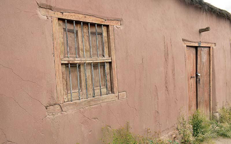
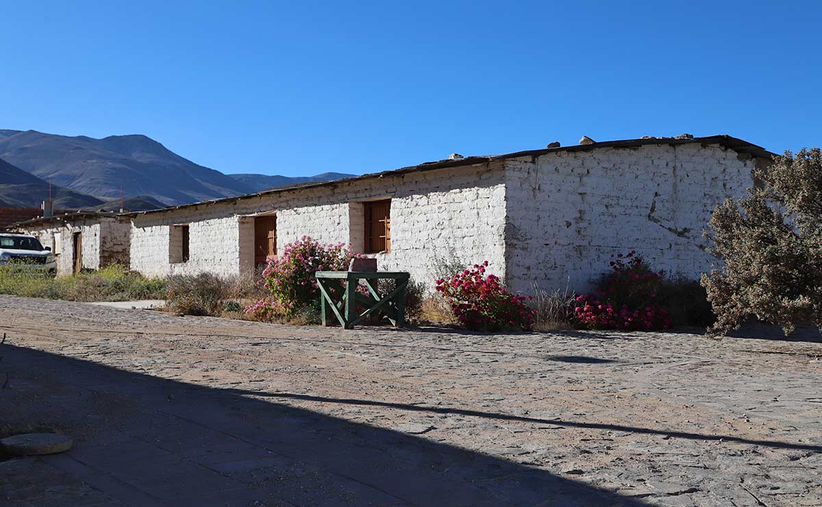
Many of the adobe houses in Socoroma remain locked, giving the impression of an uninhabited village. The people who live there, only return from time to time, forming part of the floating population.
Photo: Natalie Gilbert
Depopulation, along with road construction, shifted the Inca Trail, or Qhapaq Ñan, from a collectively maintained, vital route into one now camouflaged by the landscape. After decades of disuse and heavy summer rains, vegetation has pushed its roots beneath the ancient stones. Even though it was named a UNESCO World Heritage site 11 years ago, stretches of the trail now lie buried under rockfalls or overtaken by dense growth.
Many locals say the World Heritage inscription made things worse. Maintaining the trails is now harder and state involvement, they argue, has been minimal. Government agencies respond that they have worked at the pace of the communities. Yet, while the Aymara community claims the Qhapaq Ñan as its ancestral heritage, the network in Chile still lacks a designated manager.
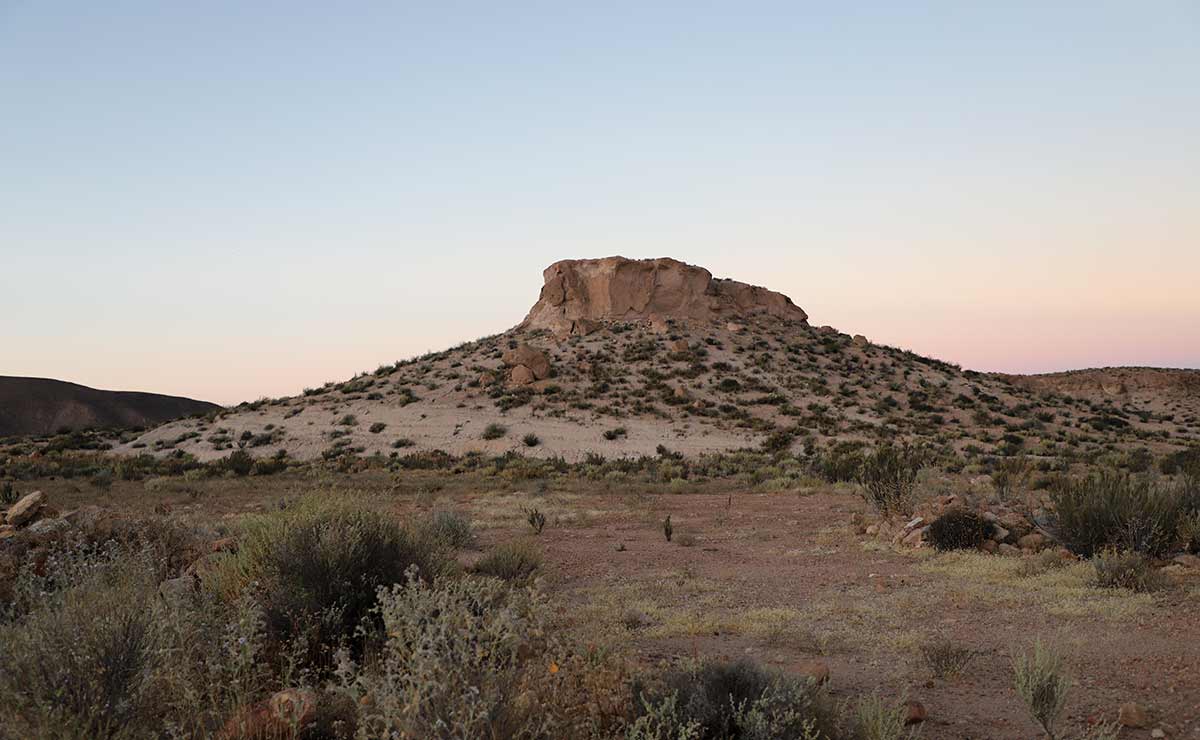
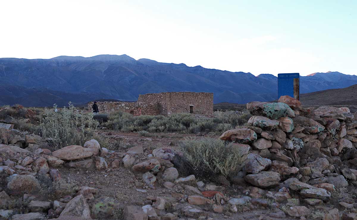
Meanwhile, climate change is further heightening the risks. Rising temperatures and more intense rainfall have already caused damage to other Qhapaq Ñan sites in Chile such as Tambo de Camar in Antofagasta, where stone corrals were washed away during a 2019 flash flood. Here in Socoroma, the question persists: could the lack of maintenance and oversight make the impact of climate change even more severe?
Rainfall in Socoroma, Chile, 2016 y 2025
Global Climate Crisis in Socoroma
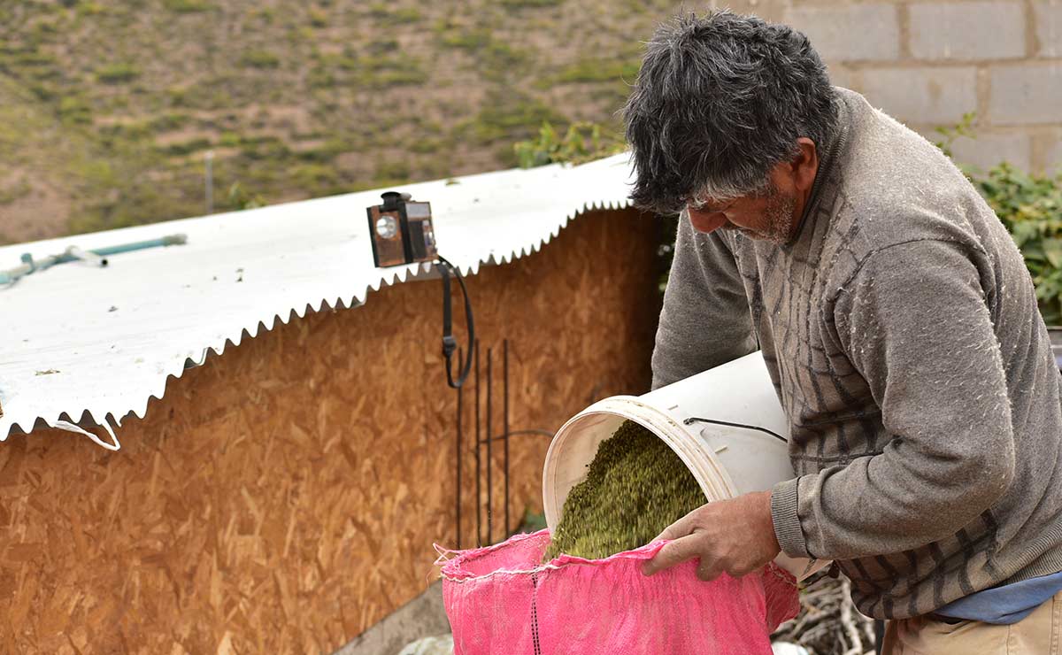
Locals in Socoroma say that while rainfall may not have increased overall, when and how it falls has noticeably changed. “It used to rain from early December through March. Now it doesn’t start until after New Year’s and it lasts into April,” says Gutiérrez.
His observation aligns with scientific research. According to Oliver Meseguer, Ph.D. in geography and professor in the Department of Historical and Geographical Sciences at the University of Tarapacá, “The rainy season has shifted later in the year.”
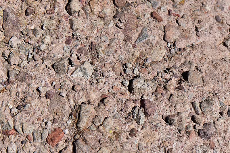
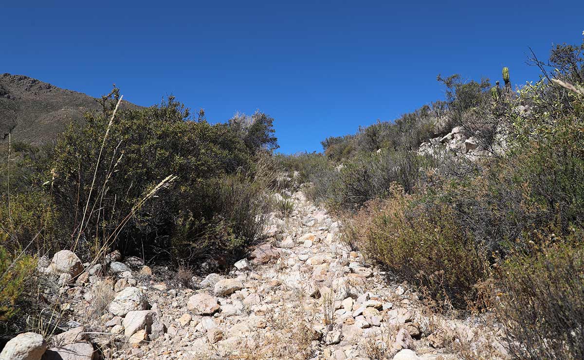
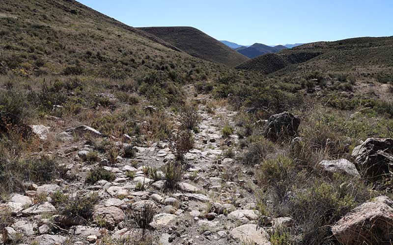
This shows the level of compaction in some sections of Socoroma’s millenary cobblestone road, a UNESCO World Heritage site.
Photo: Natalie Gilbert
Now, Gutiérrez says, watching the sky during the rainy season has become something else entirely. “In January we used to have very calm rain and in February there was thunder and lightning. That was clearly defined. But now everything is mixed. Sometimes January begins with storms.”
Those unpredictable and intense storms have direct effects in northern Chile, Meseguer explains. “We are seeing that the same amount of rain falls over fewer days, or sometimes even a bit more, and this has consequences because it erodes the soil much more. Its absorption capacity is very low. If the rainfall is more concentrated, there is much more surface runoff and that affects surrounding ecosystems.”
“The stone paths are clearly deteriorating and at risk. The lack of maintenance accumulates and accelerates the impact of even a slightly more intense rainy season. I walked the stone-paved section myself and it is fractured in five places,” warns Álvaro Romero, archaeologist and head of the Regional Technical Office of the National Monuments Council (CMN).
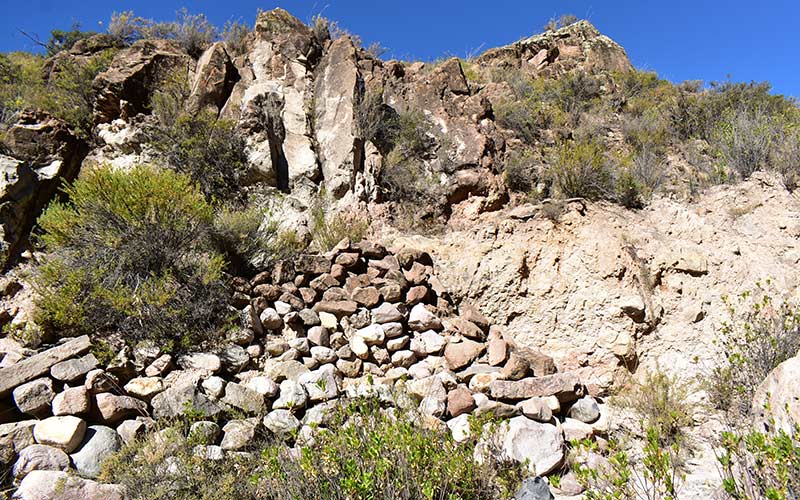
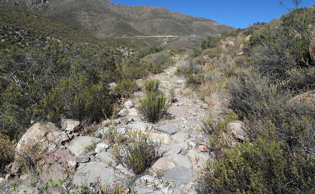
After the 2001 landslide affecting Socoroma’s Qhapaq Ñan, residents organized to build a retaining wall that remains in place today.
Photo: Natalie Gilbert
Another major effect of the global climate crisis is the rise in temperatures, Meseguer warns. Over the past 50 to 55 years, in areas roughly 9,200 feet above sea level, minimum temperatures have increased significantly, about 1.3°F per decade.
This increase was also identified in the 2024 Report of Chile’s National Climate Change Adaptation Plan. The report also warns that the zero-degree isotherm—the elevation where precipitation shifts from solid to liquid—has been rising. This could lead to “mass-wasting events or sudden increases in river discharge, generating additional impacts on ecosystems and infrastructure.”
Viewed from Romero’s perspective, this is a situation that demands urgent attention. “I am of the view that we must prioritize urgency, otherwise, we could lose it. This stone-paved section in the Arica y Parinacota region does not exist in Antofagasta or Atacama.”
Daily temperature in Socoroma, Chile (2016-2025)
Crossings of the Qhapaq Ñan in Socoroma: Tracing the Past
Along this system of routes that threaded across the Andes, shaped by the rise of pre-Inca civilizations such as Caral and Tiwanaku, different peoples traveled, carrying with them customs, practices and ways of life. This is what Carlos Choque, Ph.D. in Anthropology and professor in the Department of Historical and Geographical Sciences at the University of Tarapacá (UTA), has documented. From his office in Arica, he speaks at length about Socoroma, the village he is from, and about the history of these roads which, according to his research, form a dense and longstanding network throughout the region.
Choque also points out that these very same routes survived the forces believed to have brought down the influential pre-Inca Tiwanaku civilization. “Alan Kolata proposed several explanations for Tiwanaku’s disappearance. The main one is a major climatic shift that led to prolonged droughts, which may have caused the society’s collapse and a loss of legitimacy for the ruling elite.”
Local communities, including the Arica Culture along the coast and the Altiplanic chiefdoms in the foothills, continued to occupy and maintain the network as an essential engine for their survival., Choque explains. Then came the expansion of the Inca Empire. In this way, the ancient paths built by the great empires of the past, sustained by local peoples and later refined by the Incas, became what we now know as the great Qhapaq Ñan.
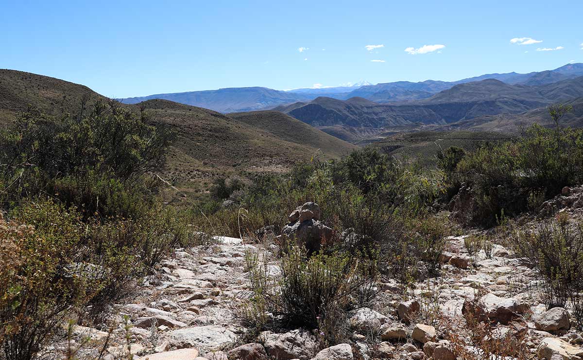
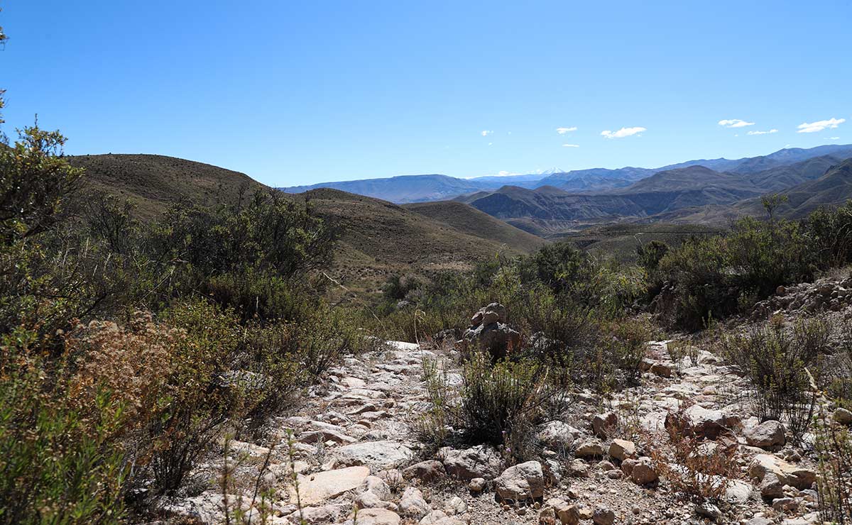
By Isha Veloso. Remains of the cobblestone section of the ancient Qhapaq Ñan road, a UNESCO World Heritage Site, connecting Zapahuira with Socoroma in the Arica and Parinacota region of Chile.
Photo: Isha Veloso
But the Inca Empire eventually fell. There was no way to withstand the Spanish Empire, which strategically appropriated the Qhapaq Ñan, using it for colonization, evangelization and dispossession.
Centuries later, these same routes became drovers’ paths, used by the grandparents and parents of Socoroma’s current residents. “The elders said they used to go out to repair the trails when the rains damaged them. Back then, people did a lot of communal work. They would spend entire days clearing and fixing the path from Socoroma to Lluta, carrying food and tools. It was a shared responsibility. Everyone who used the road had to go,” recounts Gutiérrez.
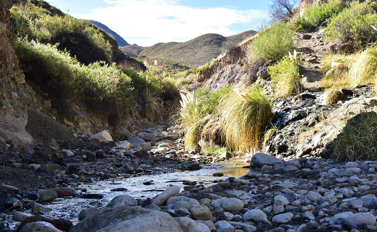
Unlike the long-term climate change experienced by the Tiwanaku, the same channels that look dry and desolate in lean seasons, revealing their sandy, silent beds, burst back to life in full force when the rains arrive between the end of one year and the beginning of the next. At times, those rains were so intense that they flooded parts of the Qhapaq Ñan that descended from the Andes toward the sea.
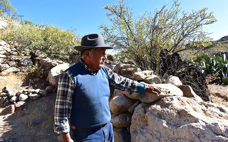
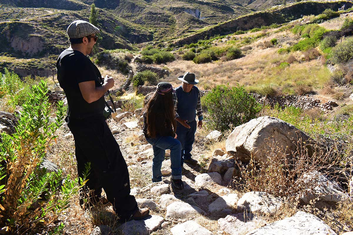
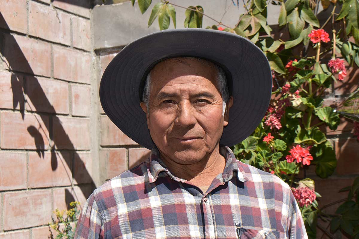
José Flores is a farmer, churchwarden and local guide who leads tours along the Qhapaq Ñan..
Photo: Natalie Gilbert
José Flores is a farmer and the person in charge of managing irrigation water. He is also the fabriquero de iglesia—keeper of religious traditions. As a young man, he left. When he was older, he returned and stayed. Today, he is also a local tour guide.
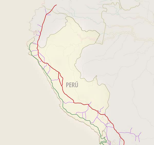
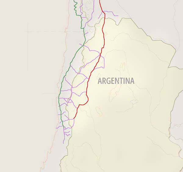
“How many times did I walk that road? So many years. It connects to Peru, up toward Tacna, and to the east, Bolivia. The stretches and branches intersect everywhere,” he says. “We used the Qhapaq Ñan that goes toward Putre. And the one that goes south from Zapahuira to Muntane. I used that up until 1995 with my mother’s animals. We moved through there when pasture was scarce.”
What Lies Ahead for the Inca Trail?
Beyond climate pressures and lack of maintenance, the Qhapaq Ñan in Socoroma faces other threats. Certain development projects, meant, in principle, to improve quality of life in the highlands, have instead damaged sections of the trail. The installation of Rural Potable Water in Zapahuira and upgrades to International Route CH-11, which connects the area to Arica, both impacted the UNESCO-protected heritage site. Across perspectives, the assessment is consistent: without clear policies to protect the trail and mitigate ongoing impacts, neglect continues to grow and potential damage increases.
“It’s politically incorrect to say this, but it’s the reality. The World Heritage designation should not have happened without a clear management framework. In Chile, that framework did not exist, it was only a promise. But they went ahead and inscribed it anyway,” says Romero. “In World Heritage sites, management must take place in the territory. That’s how it works everywhere else. Easter Island, Valparaíso, Chiloé. The only heritage site in Chile without an on-site administrator is the Qhapaq Ñan.”
Claudia Prado, archaeologist and head of the National Institute of Cultural Heritage, which is part of the National Heritage Service of the Ministry of Cultures and the Arts, confirms that eleven years later, management of the Qhapaq Ñan is still being developed and that the best governance model has yet to be defined. “There is no single model and we cannot define it without consulting the different communities. We are not going to impose one.”
In Socoroma, opinions differ. Residents say they have been waiting many years for change. Prado maintains that progress has been slow due to the dynamics of the community itself. More than 1,200 miles away from the National Institute of Cultural Heritage, Nancy Marca explains that the community chose to break ties with the government. “They wanted to declare more sections of the Qhapaq Ñan. That made no sense if they were not protecting what was already declared. The community saw the government’s failure and stopped allowing it to intervene.”
Despite the controversy, Marca is open to renewed dialogue, but firm regarding who should manage the trail. “I am not trying to close the doors. These roads are from time immemorial and belong to the community. We walked them when we moved cattle and sheep, our neighbors walked them, the muleteers who passed through Putre or Zapahuira walked them. All these roads are our heritage, not the government’s. That is why the community must be the one to administer them.”
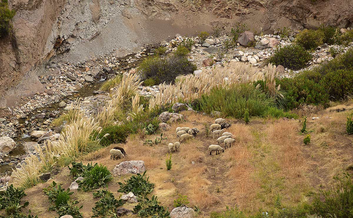
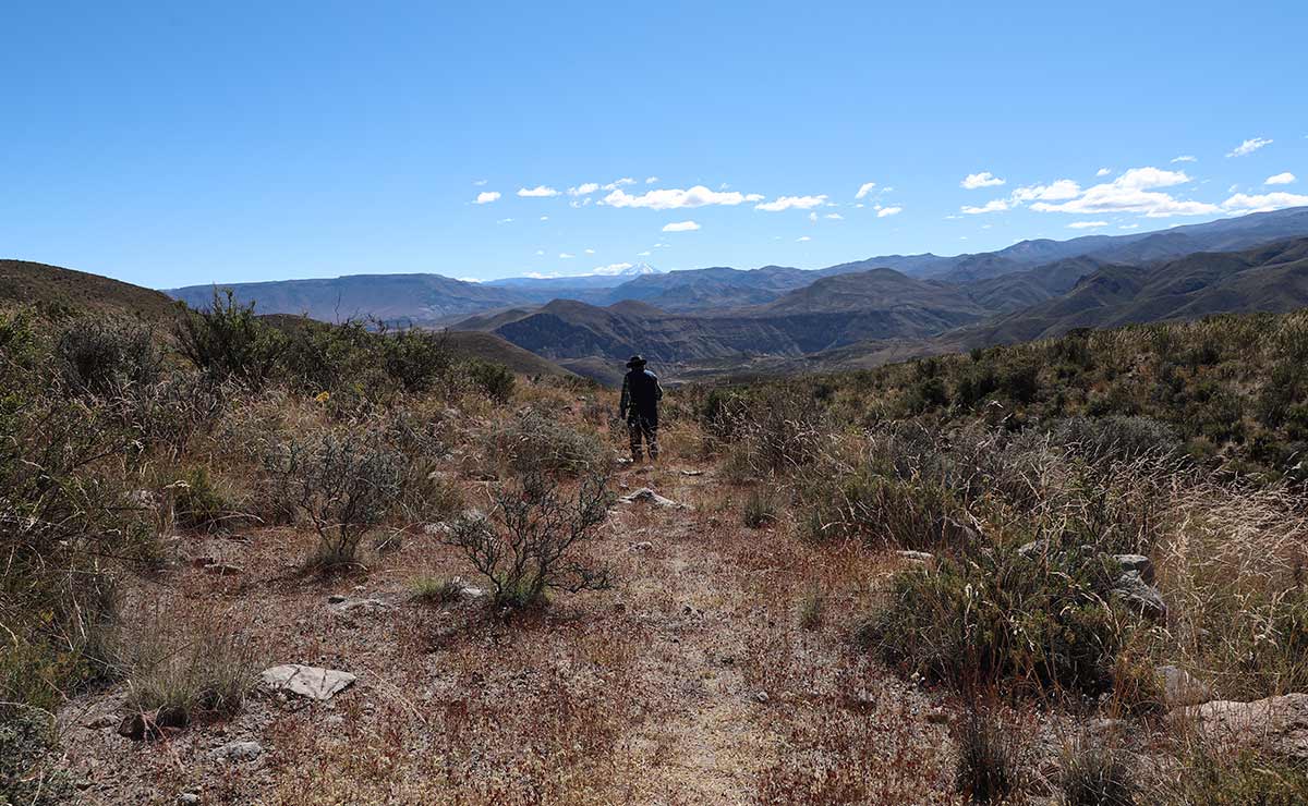
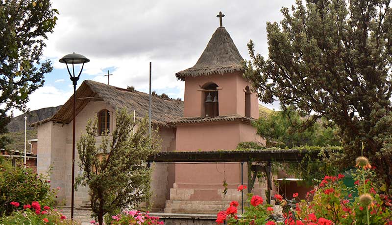
Panoramic view of the section of the Qhapaq Ñan not designated as a UNESCO World Heritage site that links Socoroma with Putre. The stone walls bordering the trail have been gradually restored by local residents with support from the Putre municipality. Photo: Natalie Gilbert